Exploring Telford
The Railways of Telford
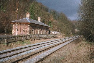
This is a section of the GWR line from Craven Arms to Wellington, joining the Shrewsbury and Hereford line at Marsh Farm Junction between Marshbrook and Craven Arms. The OS Series 1 reprint shows the line terminating at Lightmoor (actually some half mile south of the village), where it met the line from Naird Farm at an acute angle. Although it thus appears that, for a time, there was a gap in that line, I believe this may have been for a very short period. There was a station at the south end of Coalbrookdale, with an approach road to it from below the floodgates at Upper Forge, now the top end of Dale Road.
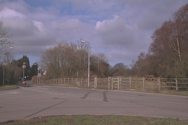
At the Lightmoor Junction there is still a signal box. The Birmingham branch can be seen approaching from the left, whilst the track to the right is the Wellington line; Coalbrookdale straight ahead.
Dave Cromarty tells me that
the line from Lightmoor as far as Horsehay was retained for quite a few years to serve the Adamson Alliance works (former Horsehay Co) across the road from the Telford Steam Railway's depot: certainly until at least December 1976.
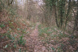
The line curves round to the left, now in use as the drive to the signal box off the Ironbridge Bypass road. Once across that and heading north, the track turns right; but a scramble up a steep bank reveals the line of the railway continuing forwards. There must have been an embankment or viaduct here, since there is a gain in height of some ten to fifteen feet from the other side of the road a hundred yards back. Destroyed by later mining? Or more recently, when the road was built a dozen years ago?
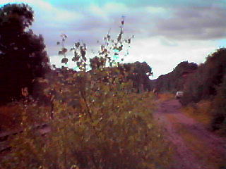
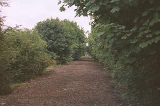
Ten years ago, when I first walked it, this railway-cum-path was still quite wide; but now it has deteriorated at the southern end to a narrow path. However, the remains of ballast make for dry and easy walking. The line climbs steadily from here all the way to Lawley Station (at Heath Hill), and especially between Lightmoor Road and Horsehay alternates between cuttings and embankments to achieve that.
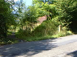
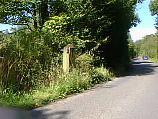
It crosses a path from Castle Pools to Lightmoor, then crosses Lightmoor Road about half way between Little Dawley and the Ironbridge Bypass, just above the Neighbourhood Initiatives Foundation at Leasowe Green, where the residents have built their own homes. Ten years ago the rails were still there, and there remain two oak posts (here's one), with the top hinges that presumably held the crossing gates. 2010 - not any more: when the road was resurfaced, sadly, the post was grubbed up.
Passing behind Leasowe Green, the line makes its way to Gravel Leasowes, originally a squatter development, where road, canal and railway come together. The railway superseded the canal and is built on the towpath.
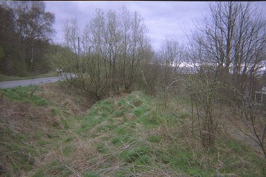
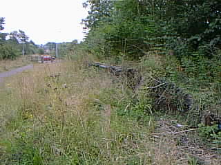
Part way along this section a set of brick and concrete steps remain, which gave access to the line from the junction of Gravel Leasowes and Holywell Lane. At the end of the section, the canal veered left, the roads converged and there was a level crossing, of which the rails still remain in the road (giving a clear indication of how much it was widened some years ago; but they were lifted and relaid when the road was widened, and the alignment is clearly wrong!). That was probably when the crossing gates were removed - these, too, were there ten years ago.
Beyond this point the railway is a broad track. On the left as you continue can be seen the fire-damaged but unmistakeable remains of Doseley Halt station platform, which is not shown on my maps earlier than the 1956 one. The platform is quite short - one carriage only, I judge.
The line continues to climb, on an embankment of steadily increasing height, in order to be ready for the sharp rise in the ground at Horsehay. As a result there are some fine views down across the Ironbridge Gorge, and one of St Luke's Church, Doseley, now converted to a house. It crosses St Lukes Road by the Cheshire Cheese pub on a fine, high stone bridge and climbs on to Horsehay Station.
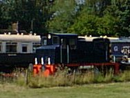
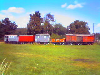
Horsehay Station is in the care of the Telford Steam Railways, who run excursions down the short length of track still existing. In fact, they are clearly extending their line, as the track has been relaid as far as the Cheshire Cheese bridge since I was last there at most two years ago.
In 1999, the hardcore was relaid as far as Doseley Halt. The Telford Steam Railways (external) had plans to reopen the line to Lightmoor Junction, and to run trains to Coalbrookdale and Buildwas. Unfortunately, I am told, the residents of Lawley protested - they seem to do a lot of that, somehow - and the project was stopped. However, they are relaying the line as far as Doseley, and reopening Heath Hill tunnel, and I wish them better success in that project.