Exploring Telford
The Railways of Telford
The Severn Valley Railway used to run from Bewdley to Shrewsbury, and the section from Bewdley to Bridgnorth is still a steam railway, running through some beautiful countryside. West of Bridgnorth the lines have been lifted. Update 2011: It is no longer true, as I originally wrote, that The map shows a road or track, but the landowners have posted notices threatening death, damnation and boiling in oil to anyone foolhardy enough to dare to walk along them: the trackbed is now a permissive path open to pedestrians, cyclists and equestrians and part of a National Cycle Route. Whether my comment that I think (it) remarkably mean of them. It seems most improbable that many tourists would attempt the seven mile walk, knowing that the walk back would follow, and the farmers surely have no damage to fear from a few serious walkers. It would have done them no harm to allow a courtesy path had any influence on the matter I rather doubt: but let me be as keen to applaud the change of heart as I was to condemn the original position.
The line approaches Telford at Coalport Station, and runs along the south bank of the Severn to Ironbridge Power Station, where the massive cooling towers block it pretty solidly. This is the site of Buildwas Junction and the start of the line to Much Wenlock and Church Stretton, of which various bridges and stations remain visible. Past there, it crosses the Much Wenlock road next to Buildwas Abbey, and there are traces of embankments and the occasional bridge in the fields all the way to Shrewsbury.
The line enters modern Telford at Coalport. One of the most interesting features is Coalport West (or Coalport and Jackfield?) station, which has been very sympathetically converted to a house, leaving the ballast of the permanent way and the platforms intact.
The line, now a popular footpath, runs through trees, and via a brick bridge over a lane off the road down to the Boat Inn and the War Memorial Bridge, to a point where it meets the road. Beyond here there has been a major landslip, and whereas the road used to go down to the right and the railway carry straight on, the old road is now a cul-de-sac and the through road, repaired in the worst place with wooden slats chained together, follows the line of the railway.
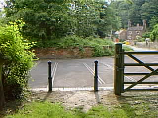
At Jackfield Tile Museum, most of the buildings have their backs to the road, which used to be the railway. The other end of the old road leads down to the museum car park. Here there was a level crossing, the house adjacent still being called Crossing House. There is no station at Jackfield on the 1924 map, but it would be odd to pass through the community without one, and Crossing House, clearly old (look at the chimney) although its walls have been newly rendered, looks as though it might originally have been one.
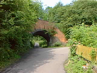
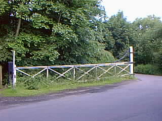
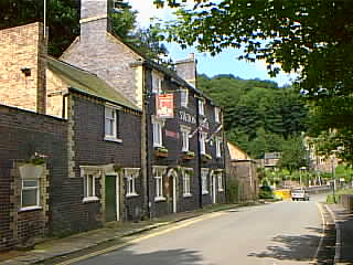
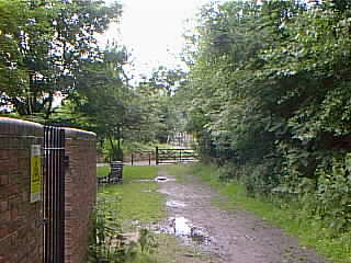
Continuing, with the railway now to the right of the road, past a left turn to Broseley, you come shortly to another level crossing. This time, the gates are intact. 2010 - Also, behind the other gate, four bits of track and a signal have been placed to indicate to tourists what used to be there. Roughly, that is - they are not aligned with ground level! The railway embankment, and a metal bridge, can be seen in the trees to the left of the road, reaching a station above the Free Bridge. It continues as a pathway through the trees until it reaches the former Ironbridge Station and yard, now a car park. But the Station Hotel, of typically railway purplish bricks, still stands.
At the end of the iron bridge the rails can still be seen in the roadway. This is one of several places where the level crossing gates still remained when I came to Shropshire in 1979, although they are gone now.
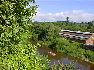
The railway continues as a footpath, under a bridge which carried a (cable?) railway straight up the side of the hill. It keeps close to the river and at one point runs on a fine brick viaduct (best seen from the wharfage, across the river), until its way is blocked by the enormous cooling towers of Ironbridge Power Station.
Dave Cromarty tells me that
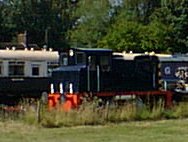
the approximate alignment of the SVR line is still in use between the end of the [railway bridge over the road] and the the Wenlock road at Buildwas Jn, for the power station traffic. This is worked on an mgr basis with the incoming trains running past the bunkers, loco running round at (approximately) Buildwas Jn, and then running back through the bunkers at 0.5 mph in the Lightmoor direction, to unload.