|
 |

Site contents © Richard Foxcroft 1996-2000
|
|
Site contents © Richard Foxcroft 1996-2000
This has been in some ways a disappointing account to write, since although there was quite a network relatively recently, almost nothing remains to look at. It is a thought, though, that if Telford Development Council in the 1970s had preserved all these lines, and the various passenger lines which still existed then, Telford would have had the makings of as fine a local rail system as need be. But of course, at that time the car was king, and the millennial worries about congestion and pollution were undreamed-of.
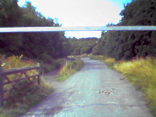
There used to be a network of private railways stretching from The Humbers in the north of Telford to a point between Dawley and Stirchley in the south. Although the lines ran close to the main lines at Donnington and Oakengates, there does not appear to have been a connection: so far as I can see, the only connection was near Hollinswood. (Anybody want to mail me different information?) Unfortunately, although some of the lines are in use as paths, very little that is recognisably "railway" remains.
The line from The Humbers ran straight, continuing the line of the canal, to Donnington, where it passed under the main line more-or-less where the main gate of BOD Donnington is today. Turning east, it ran parallel to the main line for about a quarter of a mile, before curving to the south, as marked today by a footpath and a line of poplars.
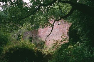
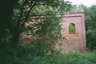
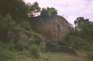
It ran straight for a mile along the footpath on the west side of the modern Donnington Wood Way as far as the next roundabout, then turned sharply east to Muxton Colliery, next to Muxton Lane, where the colliery winding engine house (Pic 1 and Pic 2)still stands, albeit ruinous. All of this section is shown on maps of 1921 and 1953 (see Sources).
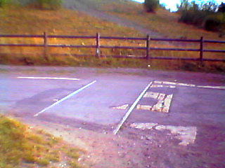
Another branch ran east then south from Muxton. That line is now a prominent footpath which line converges, at Granville Road, with another coming directly from the sharp corner of the Donnington-Muxton line, which is on neither map - yet its provenance is unmistakable in its gradient and cutting. (It does appear, however, on a map in a leaflet about Granville Park produced by Wrekin and Telford Council.) At the road, a pair of rails in the tarmac provides one of the few actual relics of what was, a relatively short time ago, a hive of activity.
Matthew O'Neill (Jan 2003) added the information that:
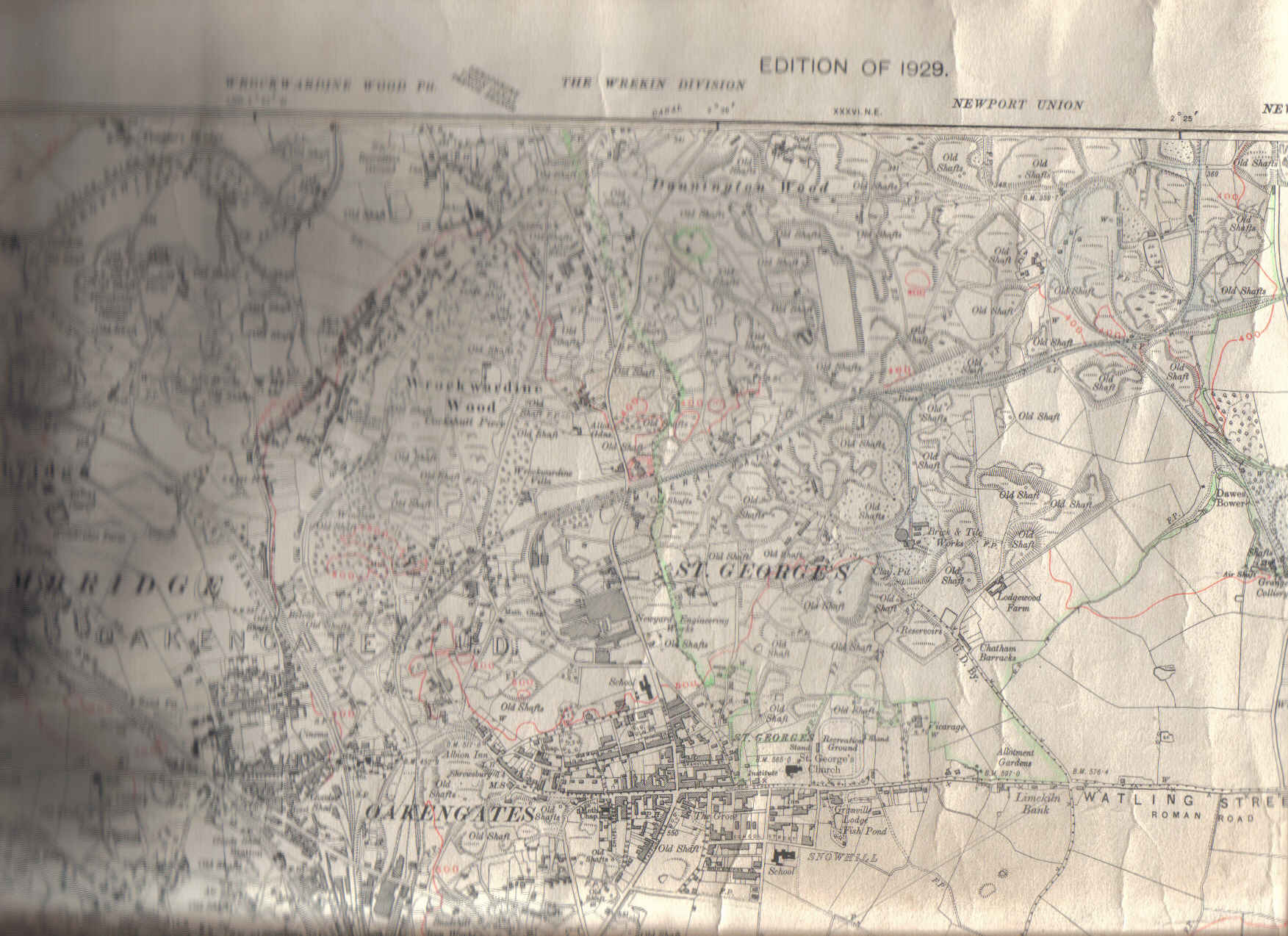
...they are the remains of the main transport line from the Granville Colliery. This line continued on to serve the Grange Colliery, Brick Works and the Lillishall Co, passing over Moss Road. This section of an industrial map from the Granville Colliery (1929 Edition) gives a fairly good outline of the area (St Georges and Priorslee).
Hidden under the mound further up is/was the loco shed to the left and the weighbridge, which totalled the output of various grades of coal and "slack" for the Power Station and for sale at the Wharf which was behind the Furnaces (ground level equal to the top of the furnaces).
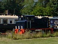
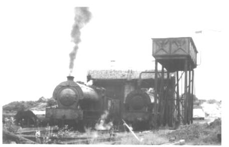
He also sent a photo entitled Last Steam
South of Granville Road, after the convergence of the two branches, the line joins a main east-west branch in about half a mile. It appears on the 1921 and 1953 maps, and the points were in the easterly direction.
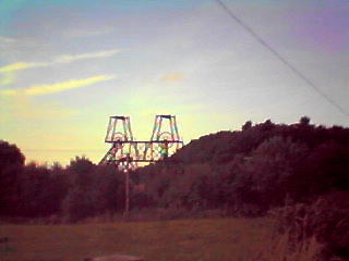
The last two collieries working were Grange, whose pithead gear still stands near the A5 on Grange Lane, and Granville, which gave its name to the Granville Country Park. The east-west line that served the Granville is shown as curving right at Grange Lane, still existing as a track, and stopping short at a building east of the huge pit-mound, now a rubbish dump, near The Woodhouse. In 1953, a branch south led to Grange Colliery, and I need to look again for traces of this. These no doubt served the nearby Lodge Furnaces.
A little to the west of the junction already discussed there was a branch north, back to Granville Road, ending in three "fingers", whose position in the road may be determined by parallel concrete strips where the rails have been lifted.
West of that, one walks along the line through a cutting and a wood. Three paths to the south forming a triangle represent the start of a short branch to another pit with points both ways (shown on both maps); the middle one of these continues, and beyond the point where the line must have ended, a steep climb up the side of the pit mound is rewarded with fine views.
This line eventually reaches well down Town Park. It runs almost due east-west, crossing Redhill Way just south of the interchange half way up the hill, then lying immediately south of Rookery Road on an embankment. It would have run along the backs of houses in Cappoquin Drive, although I could find no trace either there or between there and the now-derelict Nabb Bowling Club.
West of Moss Road there was a semicircular branch which looped round back to Moss Road to serve the industrial buildings that are now TAFS, and I think this may still be there.
Another line, locally known as the Pig Rails, ran from the canal at the foot of the Wrockwardine Wood Inclined Plane at Smiths Crescent, north of the Cockshutt, up the side of the Cockshutt to the Bowling Club, and there was a junction - somewhere - with the Muxton/Granville/Grange line. The Pig Rails was the object of local misinformation about pig farms.
From the Bowling Club, the unmetalled road known as The Nabb is the line of the railway turning south into Oakengates, past the end of Willows Road, and reaching Station Hill either via Hilton Terrace or just to the west.
All this, except the Pig Rails which is on neither, is shown on both the 1921 and 1953 maps.
So far as I know, no traces remain of any of this. If you know different, please mail me!
From Station Hill, the line continued to the far end of Eaton Crescent, then along the line of the Queensway to Lilleshall Steel at Snedshill, whose premises now (2000) stand empty and ruinous. Like everything else that connects the north and south of Telford in this area it runs through the pass between Snedshill and Ketley Bank. One railway remains, but all trace of disused lines, roads and canals has been erased between here and Hollinswood by the construction of Queensway and the M54.
It divided into two branches, one running south-east under the site of Stafford Park Industrial Estate to Stafford Colliery on the A464 Shifnal Road, now under the M54 near Priorslee Pool, ending in two "fingers". The other ran south to connect with the main line (eastbound) near Hollinswood Interchange. Part of these is the only section of all these lines already shown on the mid-Victorian map.
This line, leading off the main line (westbound), ran for something over a mile through Hollinswood, under a lane replaced by Queen Elizabeth Avenue and under Stirchley Avenue, between Randlay Pool and Blue Pool into Town Park, to Stirchley Chimney. There is a car park now at the end of Randlay Avenue, and the path from there towards Stirchley Chimney was the railway. It forks a little north of the chimney; the railway was the right fork along the side of Randlay Pool (now much enlarged as part of Telford's land drainage system and used for angling), ending close to where the end of the path from Hinkshay Road has a bridge across the Silkin Way, itself a former railway. (The strength of the bridge is such as to suggest that it was intended to carry heavy wheeled traffic - perhaps even a horse-drawn railway of some kind - to handle the goods carried by the railway.)