Exploring Telford
The Old Canal System
The canal from Wrockwardine Wood to Shrewsbury was built in 1796 as a means of conveying coal from the Telford area to the county town. In 1835 the link to Norbury Junction was opened, and so Wappenshall Junction came into being. The Shrewsbury to Norbury route became part of the Shropshire Union canal, and traded until 1935, being finally abandoned in 1944. It is shown fully, therefore, on my 1921 map. Since then, much has disappeared; indeed, quite a lot has gone since my maps were surveyed (1988 east of Marsh Green, 1971 west of there), flattened by the march of agricultural progress and blocked by road improvements. I found the area as far as Berwick Wharf quite depressing to explore - an agricultural factory where hedges, ditches and the canal are mostly gone to make way for the combine harvester, where former communities like Eyton-upon-the-Weald-Moors and Rodington have dwindled to a church, formerly splendid manor house and cluster of houses standing incongruously in a huge farmyard. I saw several once-fine farmhouses houses in a derelict state, because (presumably) the concatenation of small farms into large units leaves them redundant, whilst the area around them becomes so unattractive that they are not sought after by other buyers.
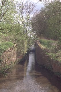
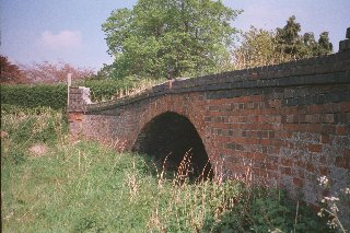
The canal junction lies behind Wharf Cottage, in whose garden the old road bridge over the Trench arm stands, and is reached through the industrial premises next door. The canal runs north-east for a mile, and is in use as a storm drain for North Telford. You can see it at Eyton, where there is another lock-turned-sluice, and follow its approximate course on a farm track to Sleapford, whilst the drain is diverted further to the south. There was another lock between Eyton and Sleapford.
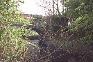
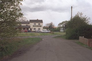
At Sleapford, opposite the Bucks Head on the A442, the road has been realigned, but the old road over the canal bridge serves as a lay-by, with a few yards of rather stagnant water in the canal bed. No bridge was built for the new alignment of the road, and where the canal ran beside the Bucks Head and under the lane to Allscott, nothing remains.
There were two bridges between Sleapford and Longdon-on-Tern, one of them under the railway. The other, which even according to my 1921 map had no road leading to it, was one of a pair on a loop of road shown on the 1850s map forming a circle east of Longdon: perhaps a path or drive round Longdon Hall?
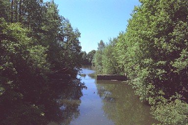
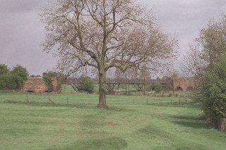
The cast-iron aqueduct at Longdon-on-Tern, inspired by a smaller one on the Derby canal and built by Telford and William Reynolds the Ironmaster, itself is the ugly-duckling precursor of that swan of canal architecture, the Froncysyllte Aqueduct near Llangollen. It still stands, with its approach embankments, bestriding the River Tern.
At Rodington, opposite Rodington court on the road from Longdon, an embankment remains, with a tunnel-like path through it, which ends at the River Tern, where according to Morriss (The Canals of Shropshire) there was once a stone aqueduct over the River Roden.
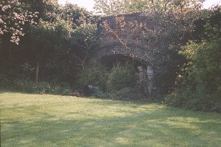
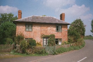
At the other side of the village, on the Upton Magna road, stands Wharf Cottage, with its lawn where the canal once ran and a bridge at the foot of its garden.
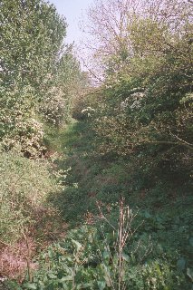
The next traces are at Rea Farm. The bridge here is gone, but the dry canal remains, extending maybe half way back to Withington (I don't think it is present all the way). In the other direction there is a path - another visit needed.
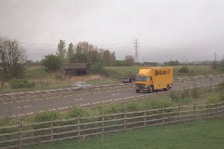
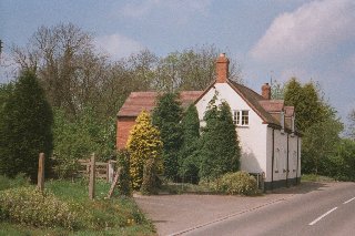
There are two bridges close together, under the railway and under the former line of Upton Forge lane, and the new A5 dual carriageway passes between them. The canal across the fields from there towards Berwick Wharf is gone - my map once again notwithstanding - but once beside the Upton Magna - Berwick road it is there, dry. It passes under the road just outside Berwick - the bridge is gone - where there is a cottage whose brickwork shows that the right-hand half of it was once something other than purely residential: did it provide some canal-side service? It stands at a strange angle to the road - its rear aligned along the canal.
Cutting the corner, the canal runs behind the houses on the Uppington road from Berwick. One of these is a half-timbered building much older than the canal; another is called Wharfside, but is either modern or modernised beyond recognition.
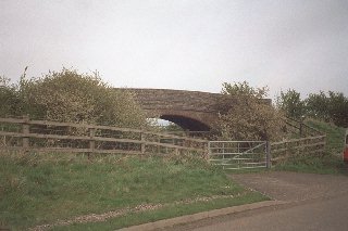
The Uppington road bridge is gone, although the canal continues to the eastern end of Berwick Tunnel. Just past the site of the bridge, the last house on the left is Canal Cottages.
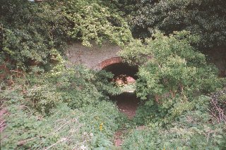
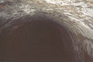
The tunnel was the longest in the county, and has a bend so that one end is not visible from the other. It was, with the canal leading to it, restored in the 1970s, but is very overgrown again now. At the western end it is sealed, but there is a gate, and one can step inside, and stare into the pitch dark, and try one's luck with flash photography. I recommend a powerful torch!
There is water in the bed towards Uppington. It turned north under the railway, and by the road crossing beyond it is dry and unobtrusive. Where it crossed the road again in Uppington I could see nothing.
From here it curved round in a semicircle, roughly parallel to the River Severn, entering the town between the Severn and the Whitchurch road.