Exploring Telford
The Old Canal System
Although much of this canal has disappeared entirely, it is shown on my 1921 map, and enough short stretches (mostly much less than a hundred yards), names and bridges are still visible to establish its course with certainty.
From the public car park at the Muxton Lane end of the Granville Country Part, the canal crossed Muxton Lane, turning sharp right parallel to the road. Was there a wharf and a warehouse here? It seems probable that there would have been, and existing buildings are aligned along the line of the canal.
Passing behind the golf club car park at the end of Muxton Lane as a dry ditch, the canal (which weaves markedly here, as can be seen on several maps) turns right again along the track to the start of the Silver Course: part of this is in water. At the groundsman's hut the path turns right, the canal continues. Several short stretches remain as water features on the course, whilst several hundred yards of dry bed run alongside the path through the trees from the top corner of the driving range.
From there the canal ran straight to Abbey Farm bridge, although I think nothing remains - certainly the landowners do not encourage exploration. The bridge stands, with a stretch of dry bed beyond it, the Lilleshall Abbey forming a romantic backdrop. Then, after passing abbey and farm, the canal turns due north to Hugh's Bridge - once again, no traces remain on the way.
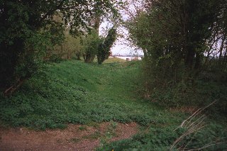
But at Hugh's Bridge there is another section of dry canal. There is a drive alongside, and a hundred yards along that a public footpath to the left marks the junction and start of the Lilleshall branch, via an inclined plane. On the current 1:25,000 map the bed is shown as going on for several hundred yards further, but the way, once again, is marked Private.
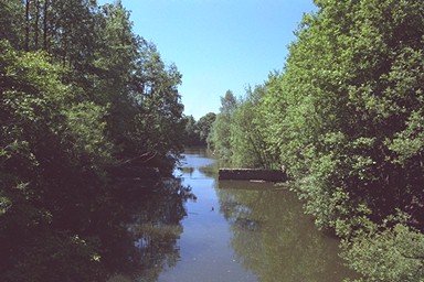
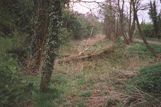
The next clue is the name, Little Hales Bridge, a mile North of Lilleshall Hall on the 1:25,000 map; and near here, across a track from a perfectly flat and smooth arable field, a short section in water runs through a belt of trees, converging on the [pic to follow] Lilleshall Hall carriage drive, where it ends.
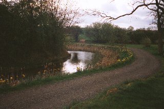
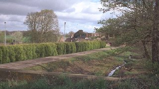
That is the end of the canal on the 1921 map, apart from a short section beyond Pitchcroft Lane: probably, it continued more-or-less straight on to that point, crossing the drive at an oblique angle. I was once told that the carriage drive was constructed on the canal: in general, not so, although maybe for a couple of hundred yards at this point it was. This pond beside the drive (another view) may be a remnant of it.
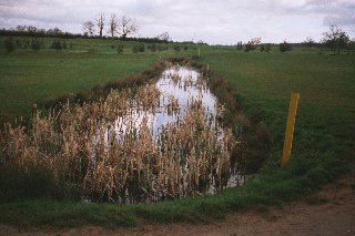
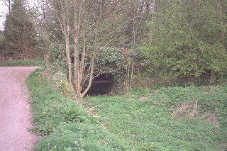
ImagelinkApproaching Pitchford Lane across another ploughed field with no trace remaining, the canal passed under a brick bridge, a few hundred yards east of Croft Farm, and beyond the bridge, the hundred yards shown on the 1921 map has become a water feature in someone's garden.
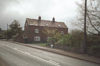
The next section is untraceable, although a path from here to Pave Lane must indicate the approximate route, and the presence of a building at right angles to the road indicates where the canal ended at a wharf on the Newport - Wolverhampton road.