Exploring Telford
The Old Canal System
Unlike its parent section, much of this branch of the canal remains, although dry.
Near Hugh's Bridge, there was originally a shaft down which boats were lowered vertically to a lower level, and I am told traces remained within living memory; I do not know whether any still do, as the landowner here particularly asked one to keep to the path as the area had been re-seeded.
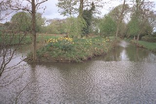
This arrangement was succeeded by an inclined plane, at the foot of which is a pool with an island, which might represent later alteration, or might indicate where there was manoeuvering-space at the foot of the incline.
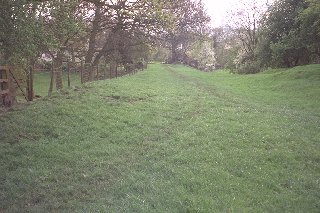
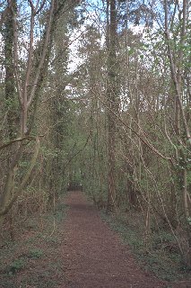
A good path by the side of a clear ditch leads on through the trees, and except for a short stretch south of Willmoor Lane, where the path remains but the canal is ploughed out, it can be followed as far as New House Farm. Here and there it even has water in it, though not much. The canal stops abruptly - filled in; but the path continues along the edge of the farmyard to the road.
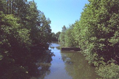
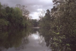
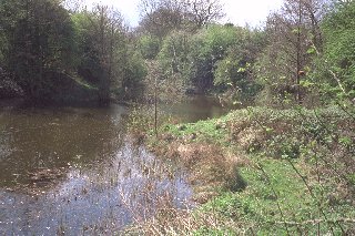
Up to this point the canal still existed, though out of use and cut off from the rest of the system, until 1921. Now the landscape changes: the path continues on a narrow ridge, with deep holes - thirty, fifty feet deep - either side. Clearly, since the canal fall into disuse the area has been extensively quarried. (Many names with "lime" in them, in Lilleshall, suggest an obvious explanation.) At one point there is also a stone-lined shaft of considerable depth to the left of the path - probably a furnace for slaking lime. But it seems probable that the line of the path is unchanged, and it continues on a level until it reaches a broad, even descent to a pool of water which I postulate as the site of the Lilleshall Inclined Plane.
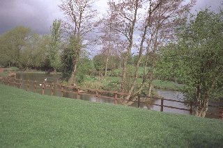
It is difficult to unravel the various short branches which once served the workings in and around Lilleshall - the land has seen too much alteration since. At the bottom of the incline is a pool. The arm to the left is rather wide to be unmodified canal, that to the right a great deal too much so; but quite possibly both were in origin. Across the neck at the foot of the incline lies an incredibly rickety half-floating pontoon-cum-bridge, with lengths of clothesline strung between trees to hang on to. Across this did I boldly go (mad fool), to find that on the far side, where the canal would have gone straight forward, is a steep climb onto a hillock - a spoil heap?
Perseverance is rewarded: bearing right at the top of the hill, there is a stile; obliquely across a wider, level path running between Lilleshall and Pitchcroft (once a plateway or light railway?) is another stile; in fifty yards the canal can be seen, in a deep cutting, and followed to its end close to the modern A518 road.
There used to be another few hundred yards to a wharf on Pitchcroft Lane, but I have not found any traces of it.
Jan 2003 - Rowland Brown tells me that some of the foregoing is wrong:
Having lived in the parish of Lilleshall for 60 years I have walked the old canal many times. Your comments regarding the canal through the quarries are totally wrong: the canal finished at New House Farm and was used to carry coal to the kilns and carry the slack lime away. The goods were transported from the canal by mine trams and the footpath through the quarries is in fact the tramway, which runs to the pool via an incline. The Limestone workings in Lilleshall and Church Aston were thought to be connected before an influx of water caused the abandmont of the workings. The deep cutting you refer to after crossing the rickety bridge is in fact another quarry known as the Long Slang. The Pitchcroft Arm can still be seen at its terminus on Pitchcroft Lane.